
Cropinno’s Satellite Farm Monitoring Service offers an advanced and comprehensive solution powered by AI for crop monitoring to empower farmers, food producers, input suppliers, agribusiness firms, banks, insurance companies, and other agricultural players to harness spatial data to elevate their businesses.
Effectively detect farm issues, identify areas requiring immediate attention, and manage fields with precision. Optimize resource allocation and make enhanced decisions based on fast and actionable data on crop health, stress, weather conditions, crop rotation, and more, ultimately boosting productivity.
Thanks to our precise satellite monitoring, early-stage detection of growth anomalies enables growers to save time, reduce costs, and increase yields.
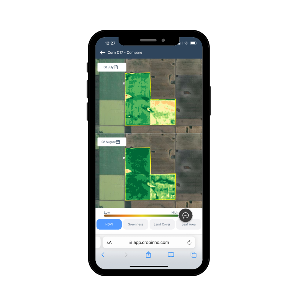
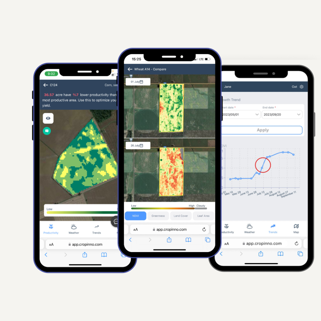
The diversity in the physical and chemical attributes of your field’s soil creates distinct zones where plant growth may not be uniform. Recognizing and addressing this variability is key to optimizing agricultural outcomes. By examining the historical data of your fields, you can make precise plans and decisions tailored to the unique needs of each zone. Our advanced productivity map goes beyond conventional assessments, offering a comprehensive view of your field’s fertility dynamics. This map serves as a powerful tool for identifying both low and high fertility spots.
Timely identification of crop stress is crucial for minimizing treatment costs and safeguarding the entire crop. Stress factors, such as nutrient deficiency, inadequate or excessive irrigation, pests infection, and diseases, can severely impact crop health. With Cropinno’s unique stress detection algorithm, we ensure regular analysis of your fields, identifying stress areas right from the onset. This proactive approach empowers you to take swift action, preventing any potential crop loss and optimizing overall yield.
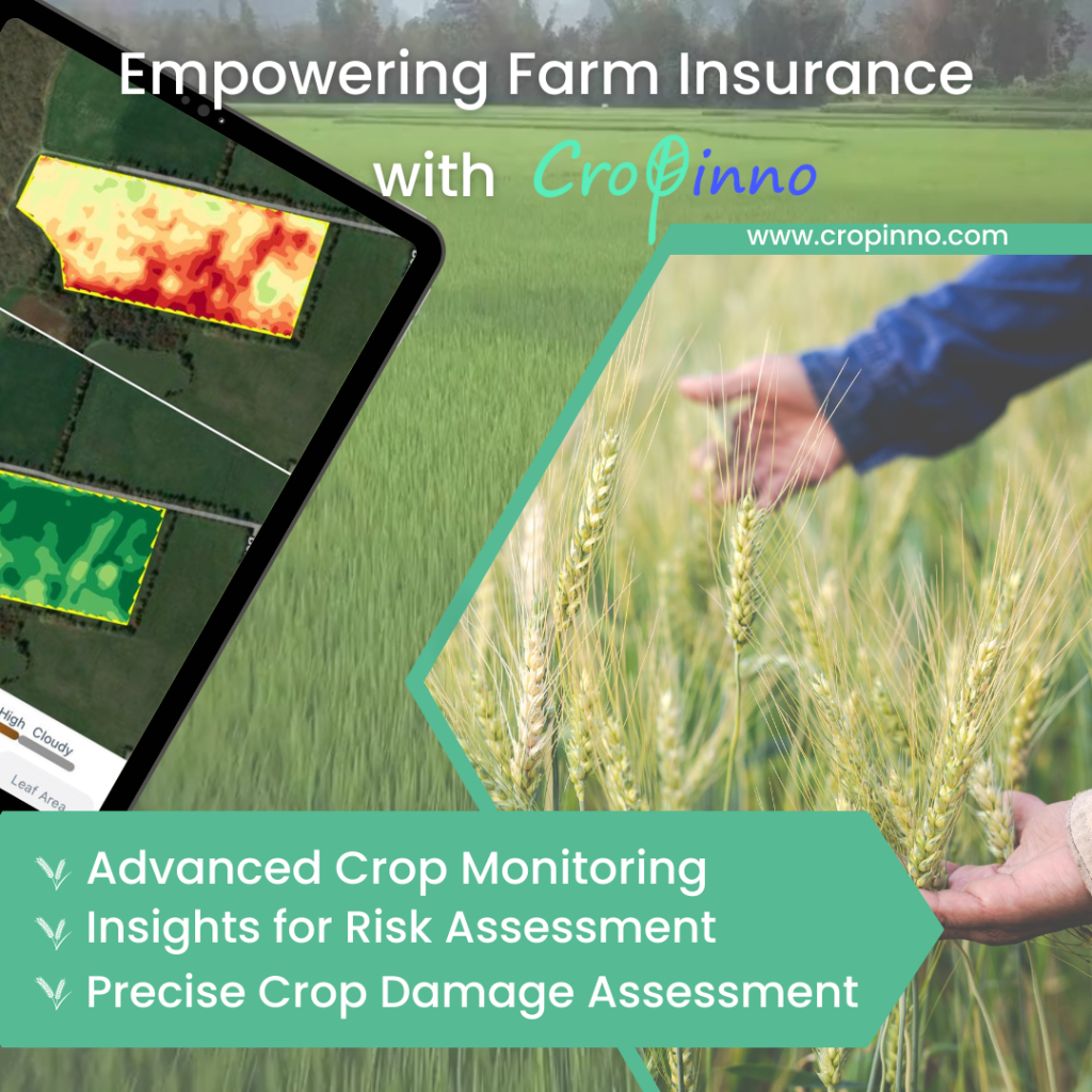
Cropinno’s state-of-the-art satellite imaging services are now available to elevate the risk assessment and damage evaluation processes, empowering farm insurance firms and adjustors to make informed decisions by real-time insights and precise analytics.
Leverage our cutting-edge satellite imagery services for precise risk assessment. Gain insights into crop health, monitor environmental conditions, and identify potential risks, allowing farm insurance companies to make data-driven underwriting decisions.
Utilize our platform’s historical data analytics to enhance damage estimation processes. Track changes in crop conditions over time, enabling a more accurate assessment of losses in the event of weather-related incidents, diseases, or other unforeseen events.
Tailor insurance policies with precision by incorporating our detailed analytics. Our services provide a granular understanding of each farm’s unique characteristics, allowing insurance companies to offer more personalized and competitive policies that align with specific risk profiles.
Expedite claim validation through real-time satellite insights. Our platform offers immediate and comprehensive data on crop conditions, facilitating a faster and more accurate validation process for insurance claims, reducing the time and resources required.
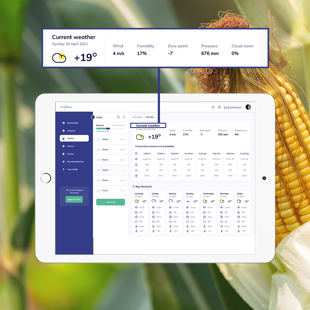
Many farmers are looking for optimizing the consumption of their own agricultural inputs to minimize their costs and maximize their yield. Having real-time, accurate and local information about weather conditions, affecting the soil and the crops is essential for precision agriculture. Also Weather forecasting for seven future days, can help farmers to plan for many day-to-day decisions. Details of weather information includes:
Our cutting-edge crop classification solution leverages advanced machine learning algorithms to provide a estimation inventory of crops grown in specific districts. Tailored for investors, advisors, suppliers, insurance companies, and governmental bodies, our tool utilizes advanced data analytics to deliver spatial information on acreage and crop types. This empowers users with essential insights for strategic decision-making, with machine learning algorithms ensuring the precision and efficiency of crop identification.
We work on several primary crops including: wheat/barley, corn, soybean, rapeseed/canola, sunflower, sugar beet, sugar cane, rice, cotton.
The Change Detection is a practical use case of satellite Remote Sensing technology to discern alterations between scenes of the same location captured at different intervals. Widely utilized for monitoring environmental dynamics, it proves invaluable in assessing the aftermath of natural disasters, tracking urban expansion, pinpointing alterations in deforestation, evaluating desertification, and identifying specific variations in both urban and natural landscapes. Offering consistent measurements of landscape conditions, this product excels in detecting sudden changes and gradual trends over time. Furthermore, it facilitates the extrapolation of costly ground measurements and strategic deployment of resources where they are most needed, optimizing efficiency in environmental monitoring efforts.
It is free to start and check our services. you can register a land with a limit of 50 hectares in the basic plan. If you wish, you can then upgrade your account to standard, premium or custom plans which are available in 3-month, 6-month and 1-year time periods (with variable discount rates).
Copyright © 2024, Cropinno Inc.